
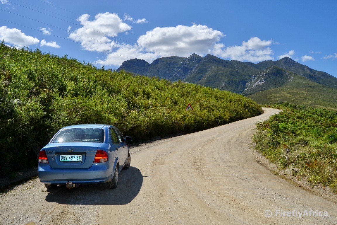
The Garden Route has many iconic passes. Some crossing over mountains and others through gorges. Some are part of main routes and are accessible to all, some are off the beaten track and only 4×4’s are recommended while others are only accessible on foot or bicycle. The Montagu Pass outside of George is one that would fit in between the first two of the options above. A dirt road over the Outeniqua Mountains, not a main road but accessible to all. The last time I drove over the Montagu Pass was probably before the KidZ were born so a long weekend in George was the perfect excuse to grab an hour or two and go exploring. And just to prove that you can do it in a normal sedan we took it on in the Aveo. Not that I have a 4×4 to do it in otherwise anyways.
Construction on the Montagu Pass started in 1844 under the charge of Henry Fancourt White – yes, the same one of Fancourt Hotel and Country Club Estate fame – using 250 convict labors. The pass, named after Sir John Montagu who was the Colonial Secretary of the Cape in the 1840s, opened in 1848 and replaced the old Cradock Pass (a hiking trail these days) which used to take travelers three days to get across the mountains into the interior.
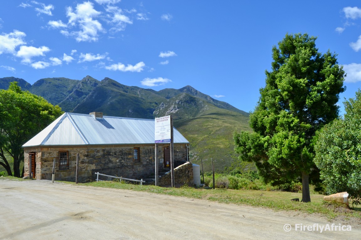
The first stop our our journey wasn’t too far up the road at The Old Toll House. I actually got a “Are we getting out already?” from the KidZ. The historic building, built of local stone, have just been restored and work was still being done on it when we passed by. This is where early travelers had to pay their toll to use the pass. The toll used to be 2 pence per wheel and one penny for each pulling animal, 2 pence for a horse, cow, ox or mule and 1 half a penny for a sheep, goat or pig. Wonder what the toll keeper would have said about the traffic using the road these days?
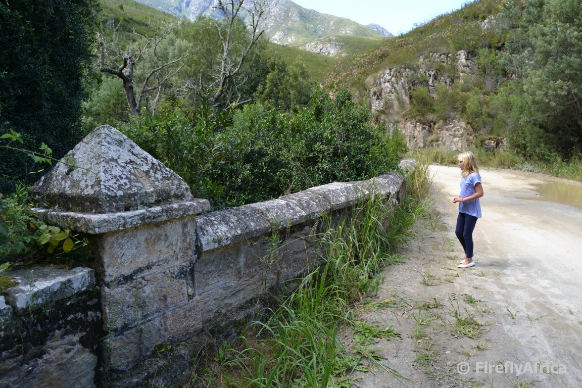
Dropping down into the valley we stopped at the old stone bridge over the Keur River. The bridge was designed and built by Charles Mitchell, another prolific South African road builder of the time. I climbed down the side of the bridge for two reasons. First to see it from the side and secondly to find the Geocache hidden there. What’s any road trip without a spot of Geocaching anyways?
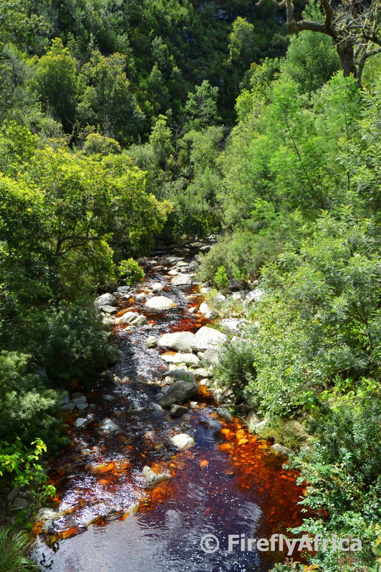
Looking down from the bridge the Keur River could be seen below with the brown coloured water that is to typical of the rivers in the Garden Route region. The brown colour is from tannin the river picks up as it flows through the forests and fynbos of the region. All the leaves and plant material that drops on the ground acts as a teabag of sort as the water flows through it, giving it this colour. The water is still perfectly clean though and used by many straight from the rivers.
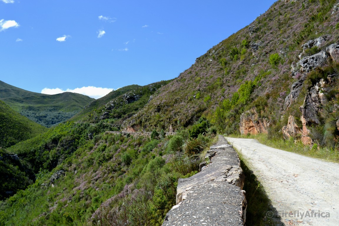
We passed through Die Noute, the narrowest part of the pass, and traveled along the valley before starting to climb out and up the mountain. It’s great to see how the original stone work is still visible on the side of the pass. No wonder as the pass is said to be the oldest unaltered pass in South Africa.
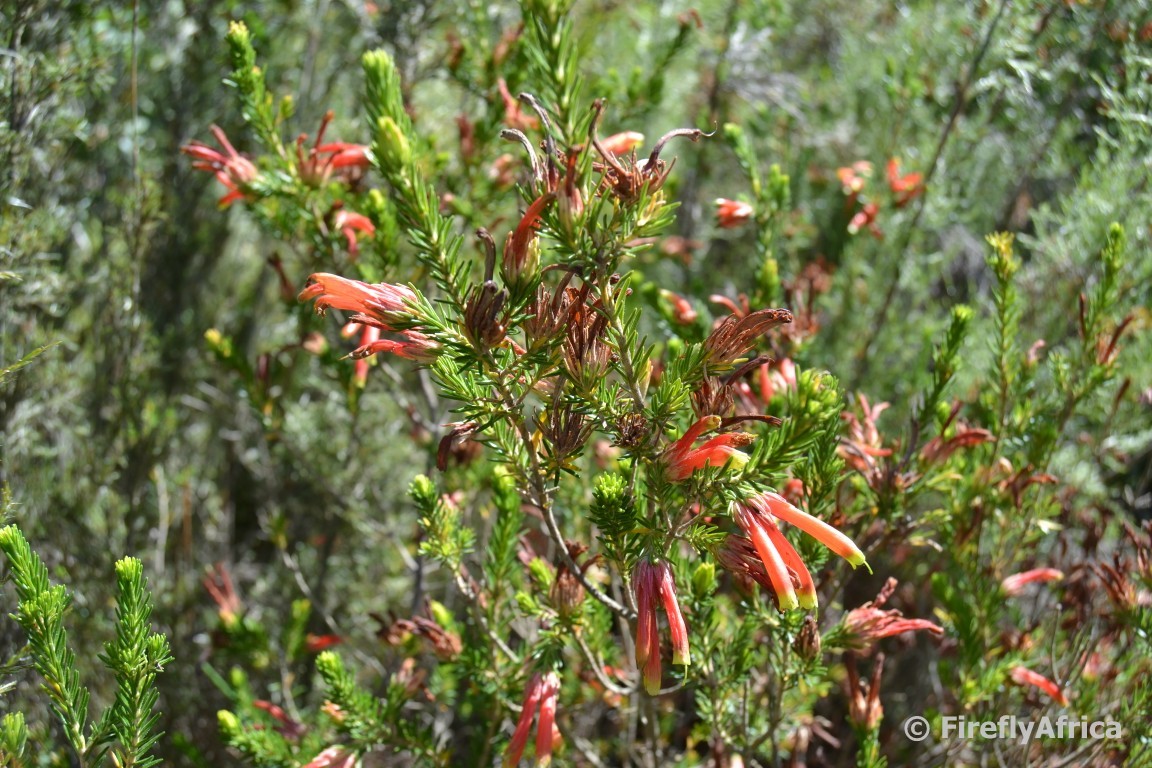
As we climbed out of the valley and up the mountain vegetation quickly change to the fynbos that covers the surrounding mountains and one can’t but help to marvel at the variety of plants and flowers visible right next to the road.
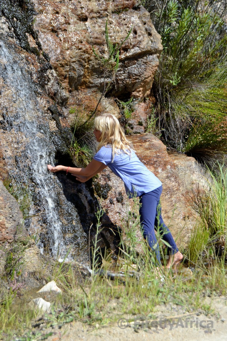
Drama Princess even had me stop at one of the spots where a stream flowed down the mountain because she wanted to feel how cold the water was and taste it.
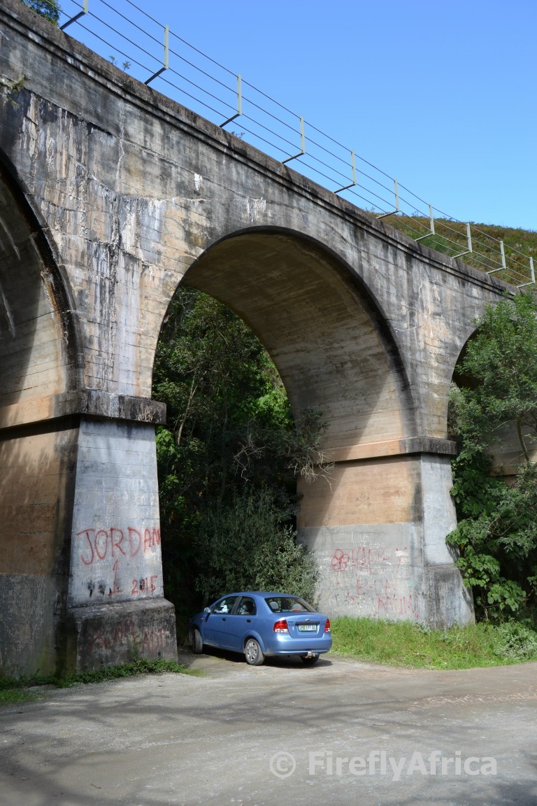
There are four passes that cross the Outenique Mountains in this area. The original Cradock Pass, the Montagu Pass that we were on, the modern Outeniqua Pass and then the railway pass. As we approached the top of the mountain we got to the first of two railway bridges you get to see while on the pass. Until about a decade or two ago there were still steam trains using this line, but these days the best way to see it is by going up the pass on the Outeniqua Power Van. Or stopping under it like we did.
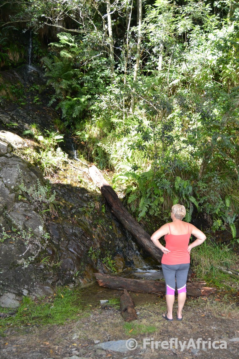
The bridge is located at Stinkhoutdraai (Stinkwood Corner) which was named after the Stinkwood Trees that used to grow here very prolifically. There are still some left these days, but many were cut down during the late 1800’s and early 1900’s. Pulling over here wasn’t just about the bridge but also for us to have a closer look at the wooded cove just behind with another stream flowing down it.
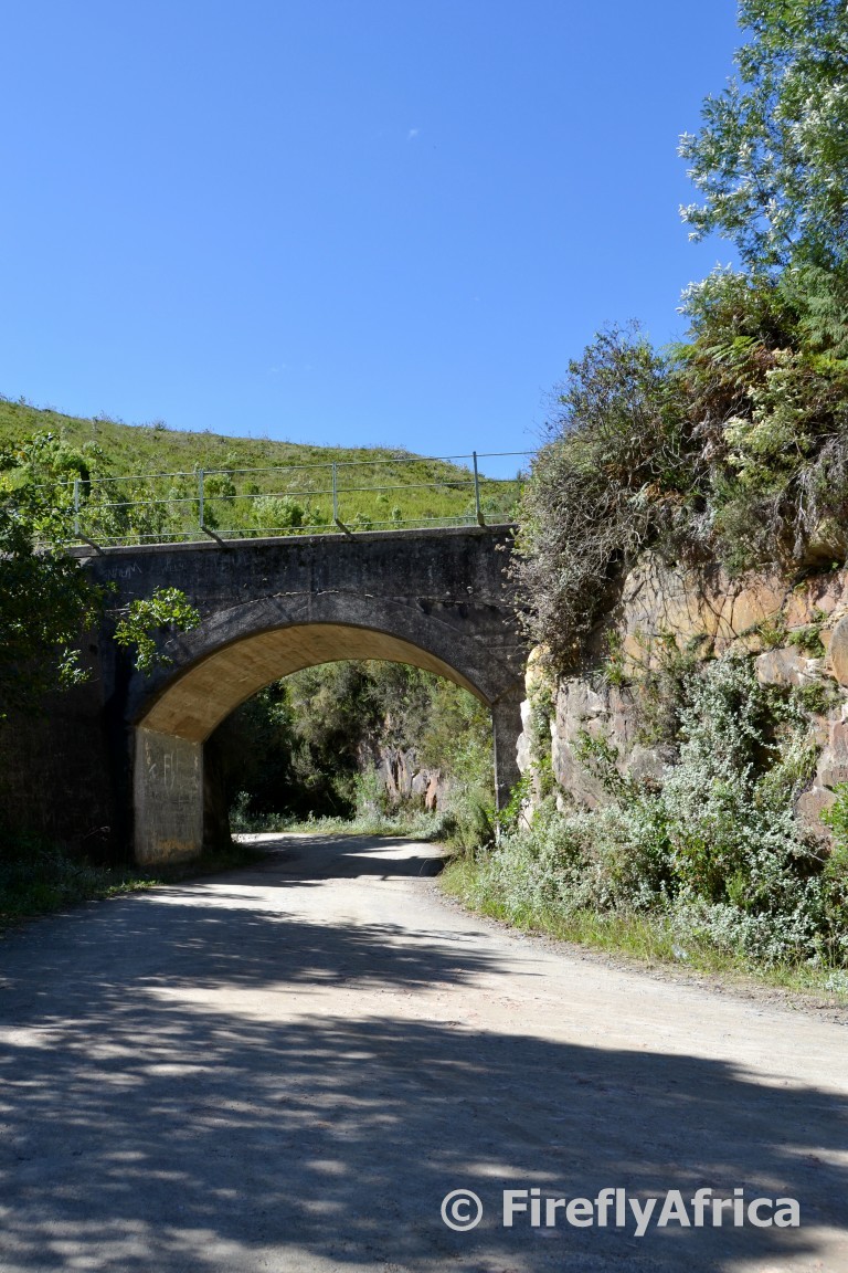
Near the top of the pass we passed below the second of the two railway bridges.
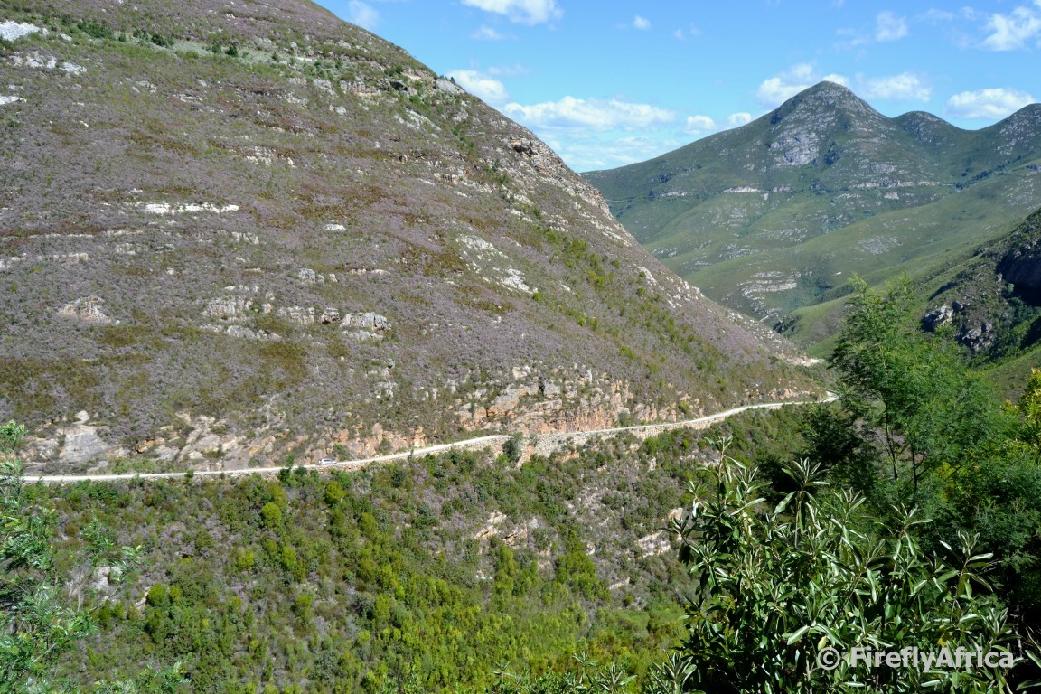
We decided not to drive out the back of the pass towards the Langkloof and back to George over the Outeniqua Pass, but to rather backtrack for a second taste of the Montagu Pass. You get to see different sights and things at different angles that way anyway. Our turning point was at Amanda’s Grave near the top from where we could look back down the pass we just came up on and was about to return back to.
It really is a pity that most people are always in such a hurry to get to their destinations that they just rush along the fastest route possible. In this case the Outeniqua Pass. But next time you are in the area, do pinch off an hour or so extra and take a leisurely drive up or down the old pass. I promise you won’t be sorry.
I'm pretty sure I drove this one but would happily do it again.