I have this fascinating interest in old graveyards and cemeteries. There is a calmness and peacefulness to them, and it’s often one of the best ways to learn more about a place’s history.
A roadtrip to Middelburg Karoo has a checklist of places I wanted to see and historic cemeteries were at the top of the list. The more I read, the more intrigued I got. There’s not a lot that I found written about the cemeteries, but picking up crumbs here and there had me dig a little deeper and target four different ones. So bear with me, this may be a slightly long post.
Three of the cemeteries are either on or linked to the Grootfontein farm where the Grootfontein Agricultural College is located.
The history of Grootfontein dates back to the 1790s, when Klaas van der Walt lived on Grootfontein and the farm covered 3,800 ha. The first official registration only took place in 1836, when it was awarded to Hendrik van der Walt and his brother Nicolaas as erfpagland (an Afrikaans term referring to a form of land tenure in colonial South Africa (similar to “quitrent”), where land was granted by the government to individuals, typically for agricultural use).
Under the successive ownership of the Van der Walt, Vorster and Du Plessis families, Grootfontein gradually grew to its present size of 11,418 hectares. The farm’s last private owners were Jan and Nicolaas van der Walt and their sister Lucia, married to Schalk Willem Vorster.
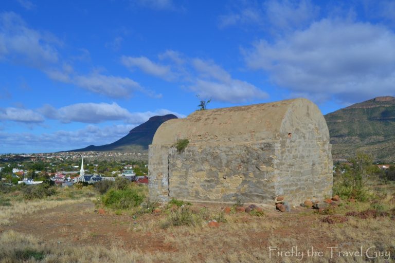
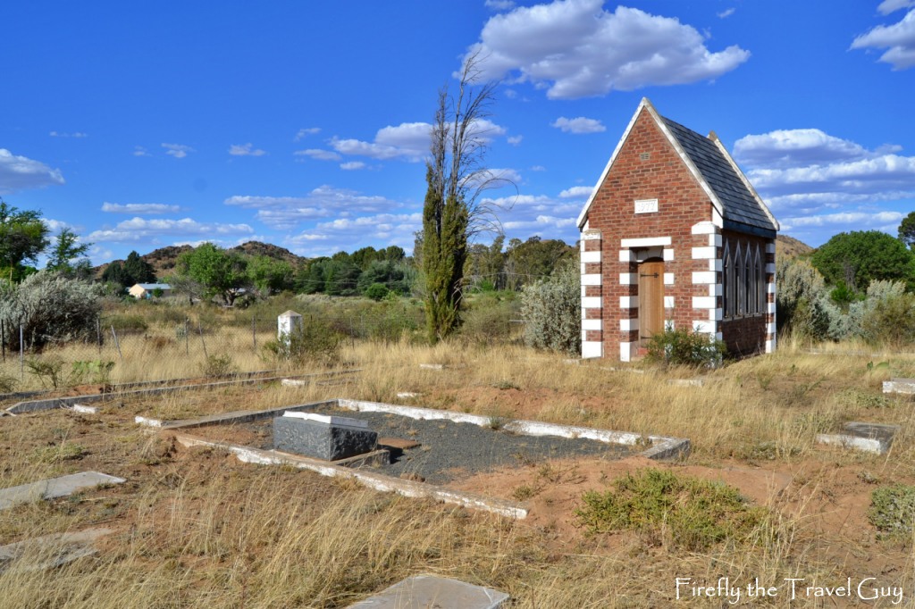
My first stop was at the Van der Walt and Voster Cemetery near the PW Voster Museum at Grootfontein. The small cemetery has an even smaller memorial chapel built in 1977 by descendants of the Van der Walts and Vosters.
Most of the graves are marked by cement slabs with only a couple of the original headstones still visible. I was curious to see inside the building, but couldn’t see inside the windows. So I gave the door a little nudge and what do you know, it opened. Inside was a memorial stone that reads, “Ter nagedagtenis aan hulle wat hier gewoon en gewerk het en nou hier rus” (In memory of those who lived and worked here and now rest here).
After the Anglo Boer War, the farm was bought by the British Department of War in order to establish a peace-keeping force in the area. This was the beginning of the military era of Grootfontein that lasted from 1903 to 1910. During this military period between 12,000 and 15,000 British soldiers were stationed at Grootfontein.
During this period most of the soldiers lived in tents until prefabricated houses were imported, made of wood and corrugated iron. Some of these houses are still in use.
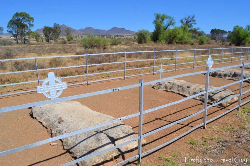
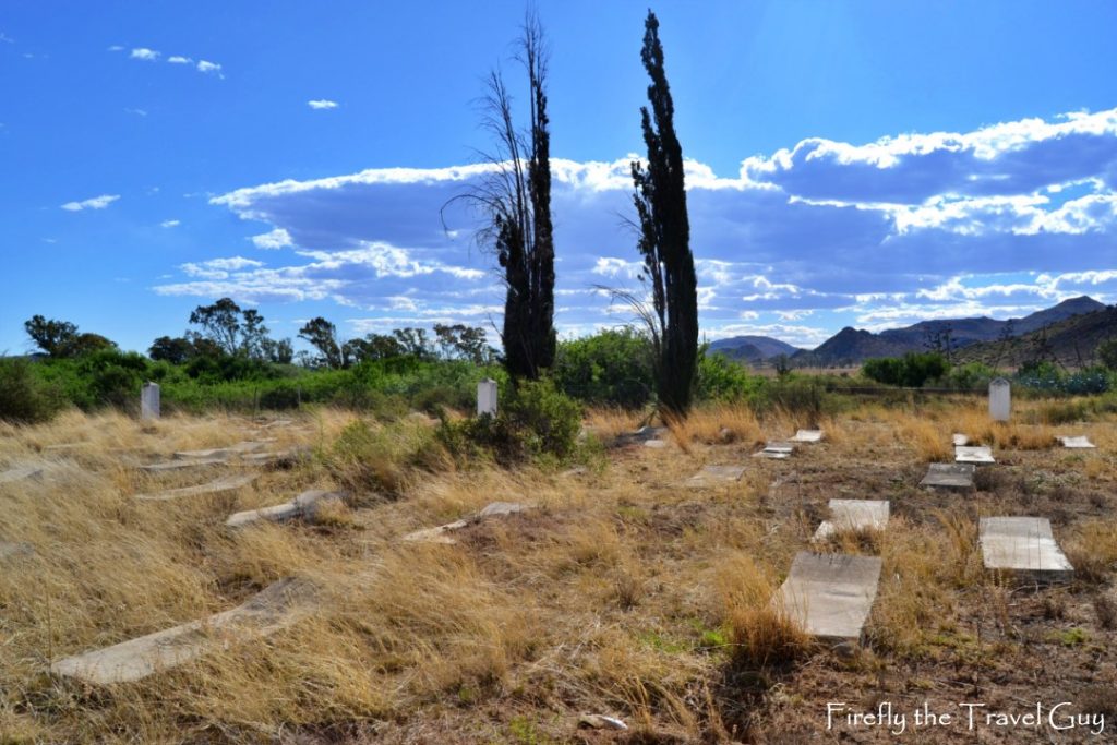
The first military cemetery was located to the east of the “Droë” river and was closed in October 1905 due to the spreading of contagious diseases. It was this cemtery that I was after. The only other reference I could find of it mentioned the name Kingsway Cemetery, but nowhere could I find the location of it. I asked at both gates but non of the security guys knew, so I decided to just take a drive around till I found somebody who knew. This somebody came in an elderly worker who gave me directions.
On arriving at the spot I could see the cemetery about 200m away in the veld. I parked just off the road and slipped through a closed farm gate, hooking my shirt and tearing my shorts. The price we pay for exploration.
The cemetery was well looked after and each section of graves were fenced in to keep cattle out. Most of the graves dated from just after the Anglo Boer War with some having headstones and others what seems to be a standard metal cross with the person’s details on it.
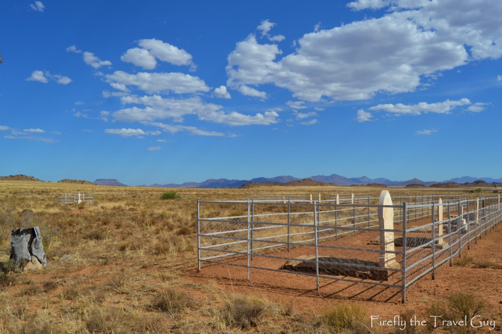
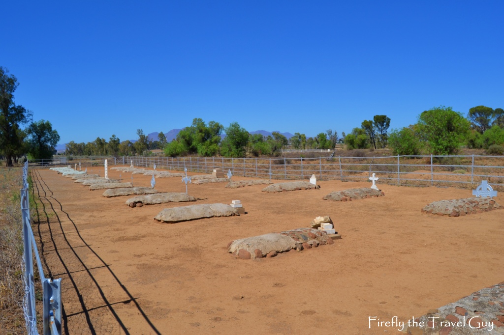
Next up I was off to the “New” Grootfontein Military Cemetery. After the closure of the cemetery on Grootfontein, a new military cemetery was established to the east, about 8 km from the military camp on the Oorlogspoort gravel road. Again I found absolutely no literature on the cemetery and only knew where I was going because it was marked on Google Maps.
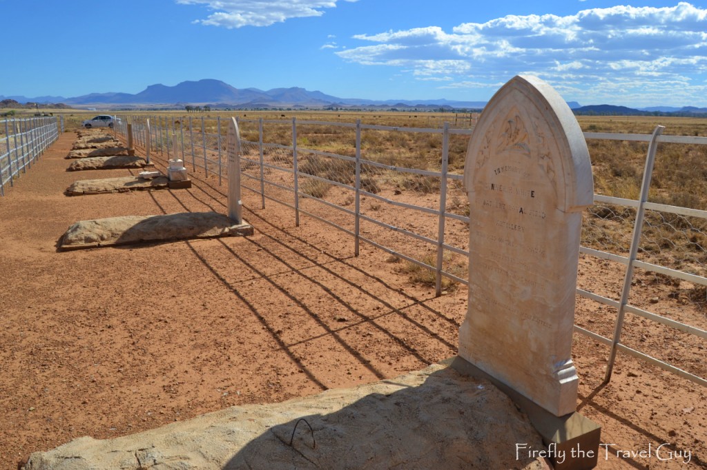
I found a cemetery very similar to the one on Grootfontein, well looked after and fenced in against roaming cattle as it is located on a farm. The cemetery was spread out a lot more than the previous one and it also had quite a few graves without any headstones or crosses.
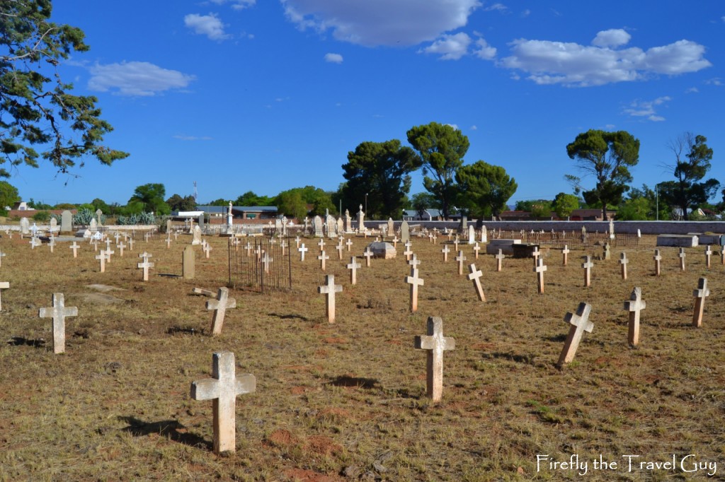
My last cemetery of the day took me into Middelburg to the town’s Old Cemetery.
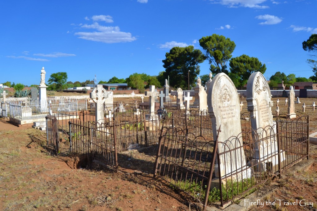
It lies at the junction of Van Reenen Street and Rosmead Street in the centre of town. There are two sections to the cemetery with the one side containing a number of graves from the Anglo-Boer War. There’s also a lot of historic figures from the town and surrounds buried here, among them John Sweet Distin, the first person in South Africa to erect stock fences.
I didn’t get a chance to go and look for the graveyard of Farm Driefontein. This is where the first inhabitants of Driefontein, on which Middelburg was founded, lay buried. Something to keep for next time. For now I’m just happy to be able to put the information about the town’s four old cemeteries all in one place.