The Tsitsikamma National Park, these days called the Tsitsikamma section of the Garden Route National Park, must be one of the most scenic places in South Africa. I know beauty is in the eye of the beholder and some people are going to say, “But what about the Wild Coast or the West Coast?” So let’s just say, the Tsitsikamma coastline is right up there. And the easiest way to see and experience it is on the Storms River Mouth Trail.
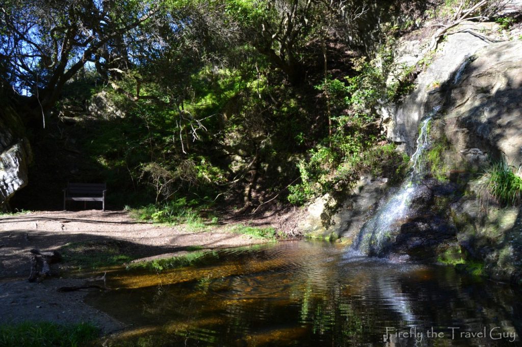
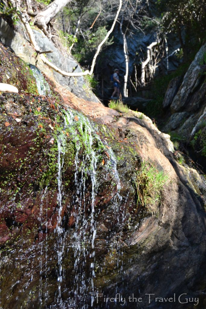
The Mouth Trail is an easy walk that starts at the rest camp area in the park and will take you 1km along a boardwalk through the forest to the suspension bridge over Storms River Mouth. It’s an easy walk, although it does have over 300 steps along the way, so if steps are a problem, rather just enjoy the view from the restaurant. After crossing the little beach, you enter the forest and immediately find a small waterfall cascading into a pond. It’s too early for a rest, but keep it in mind on your way back.
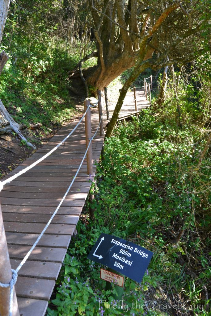
Just past the waterfall and pond is the first turnoff to the right. It leads down to Mooibaai, a small beach at the top of a deep gully through the rocks. Back in the days when the indigenous forests of the Southern Cape were still exploited for their wood, Mooibaai was one of the docking points where the wood was loaded onto ships for transport. The forest giants were indiscriminately cut down, and the wood was used to build ships and to be used in the construction of buildings.
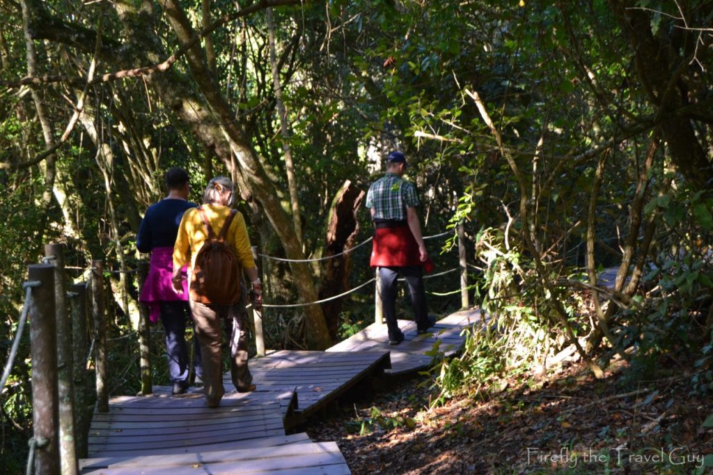
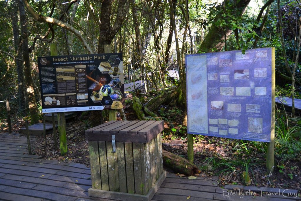
Back on the trail, you’re still walking through the forest and on the way pass the open-air classroom, where you can learn a bit more about the ecology, history and fauna and flora of the forest. This is probably also a good spot in this post to tell you a little bit more about the history of the park
During the First World Conference on National Parks in Seattle in 1962, the World Conservation Union (IUCN) appealed to governments for the establishment of marine parks and reserves. The South African National Parks Board responded with the proclamation of the Tsitsikamma National Park in 1964, making it the first Marine National Park to be proclaimed in Africa.
The original coastal park extended some 59 km between Groot River (east) (west of Oubosstrand) and Groot River (west) (at Nature’s Valley). It included the areas approximately 800m landward and 800m seaward of the low water mark.
On 6 March 2009, it was amalgamated with the Wilderness National Park, Knysna National Lake Area and various other areas of land to form the Garden Route National Park. The Tsitsikamma Section of the park incorporates 80 km of rocky coastline with spectacular sea and landscapes, a remote mountainous region with secluded valleys covered in mountain Fynbos, and temperate high forests with deep river gorges leading down to the sea.
The Tsitsikamma Section protects a wonderland of intertidal and marine life. This is one of the largest single unit ‘no take’ (including fishing) Marine Protected Areas (MPA) in the world, conserving 11% of South Africa’s Temperate South Coast rocky shoreline and provides a ‘laboratory’ for fisheries baseline research on endangered line fish species.
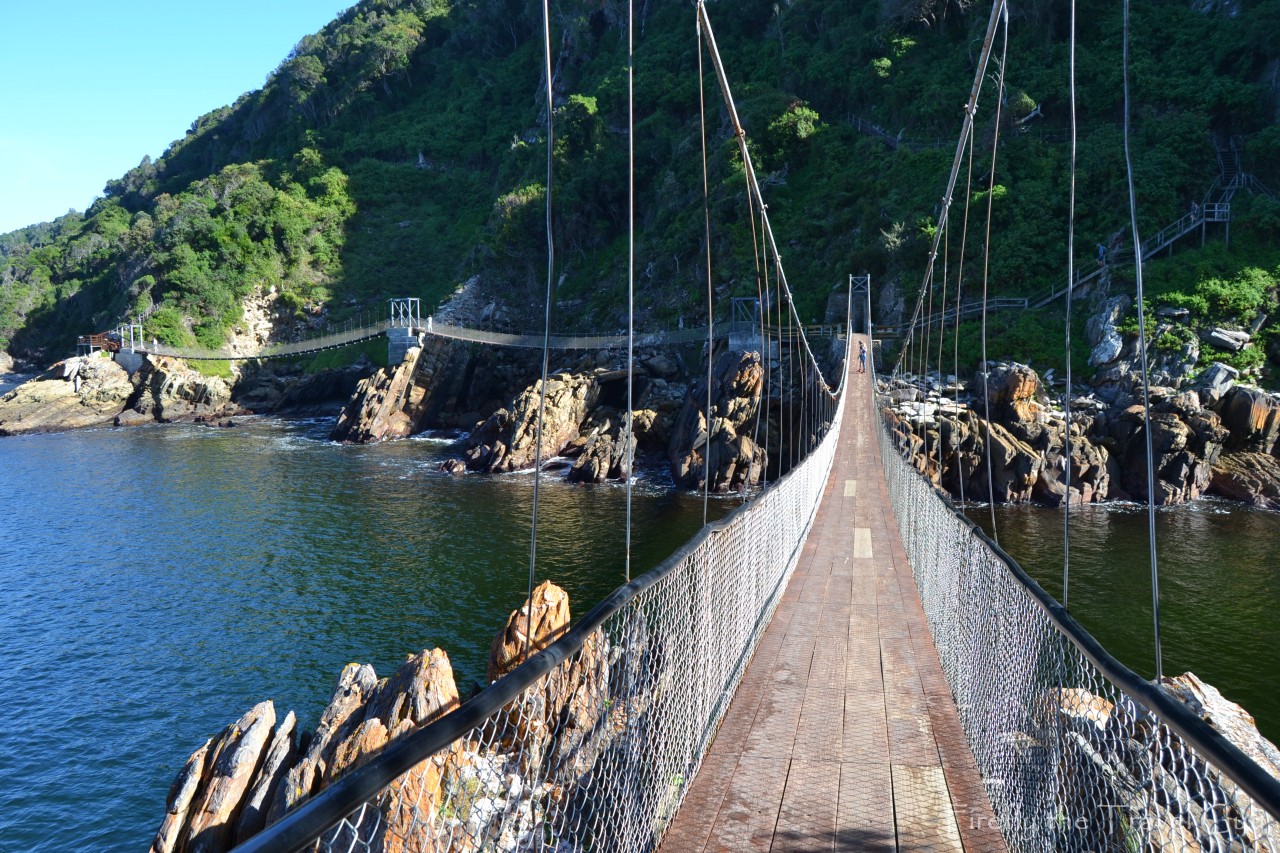
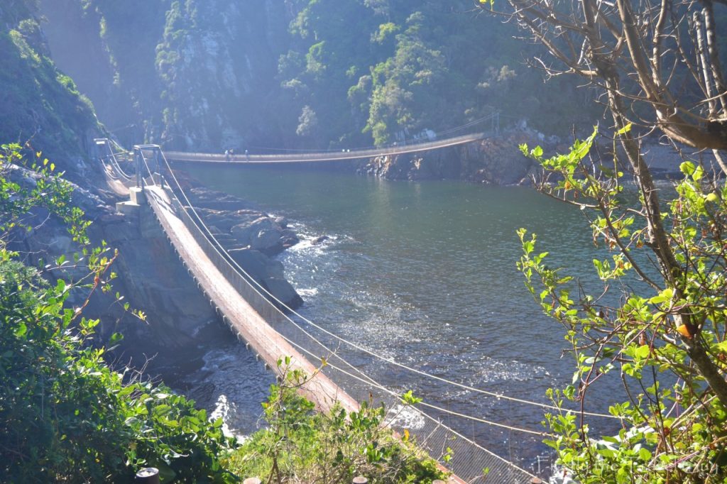
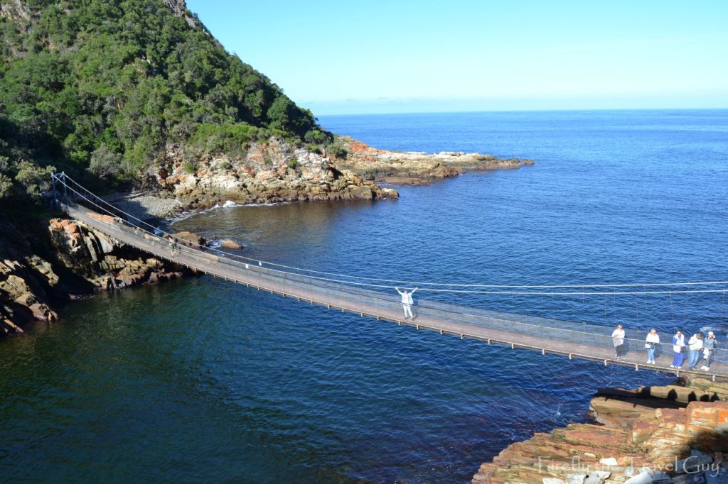
Before you know it, Storms River Mouth and the suspension bridge come into view. After a steep climb down to sea level you realise that there isn’t just one, but three suspension bridges waiting for you.
The Storms River Suspension Bridge was originally built in 1969 by Jacky De Vos. In 2006, two additional bridges were added to the site.
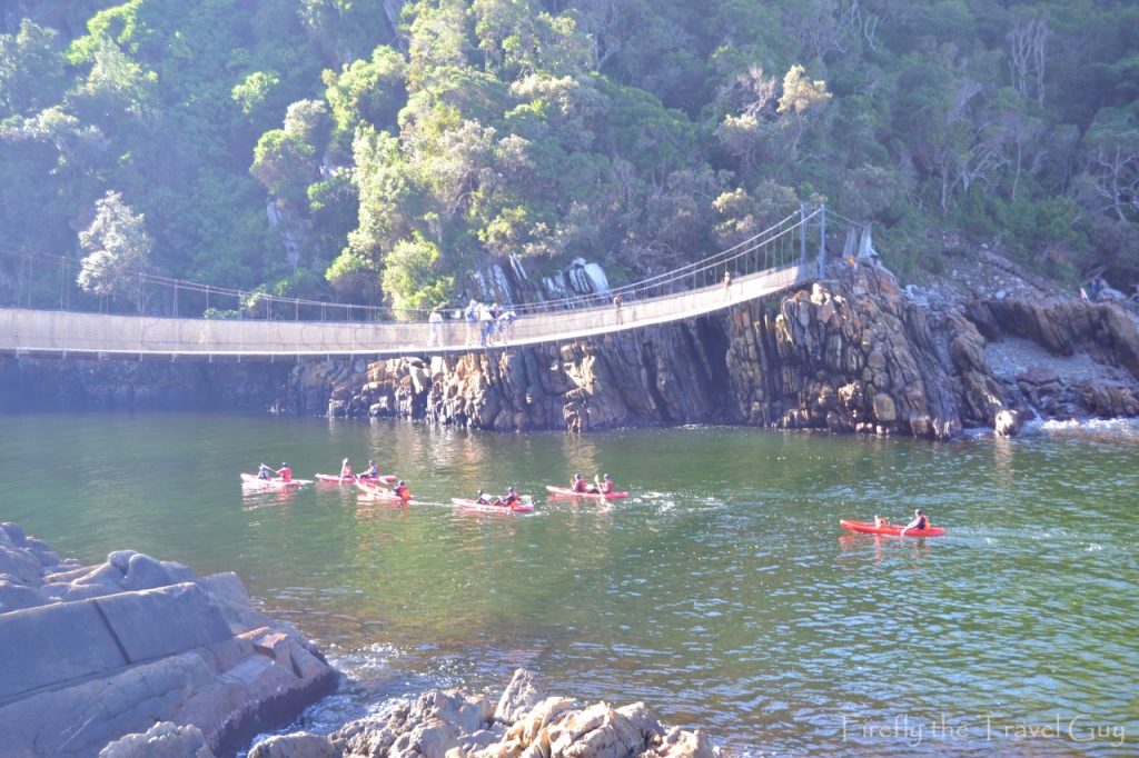
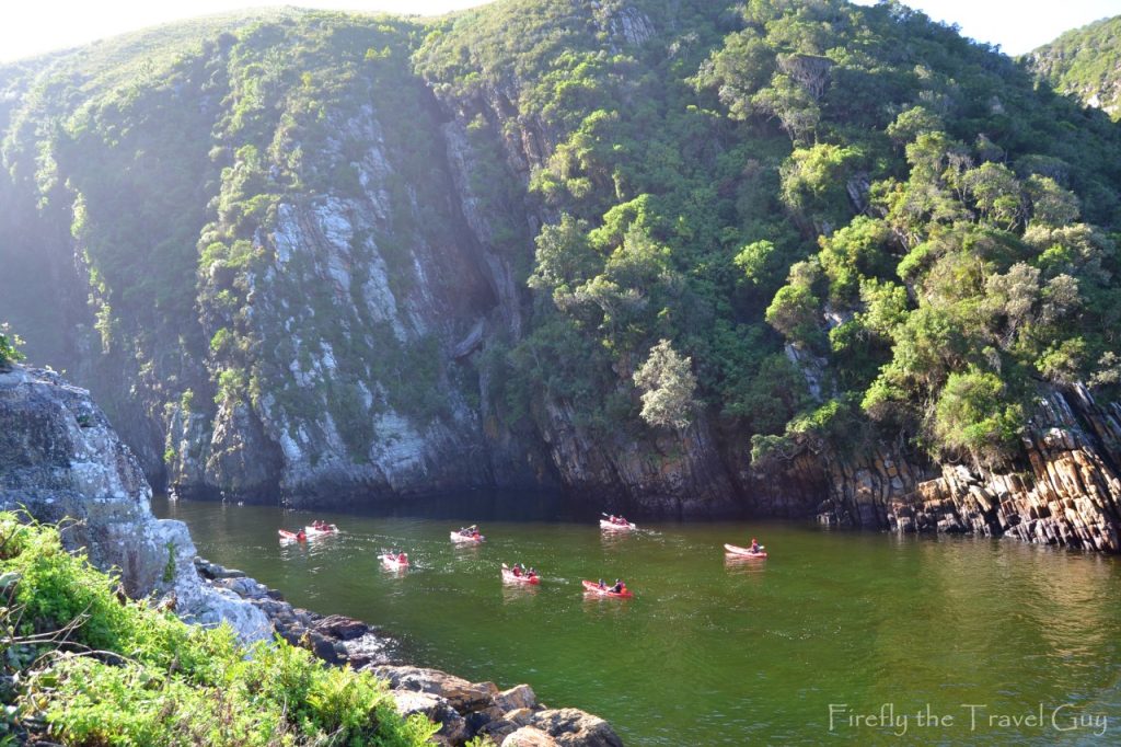
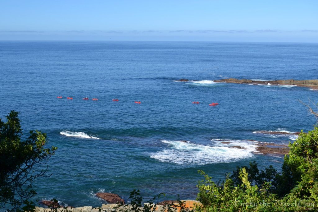
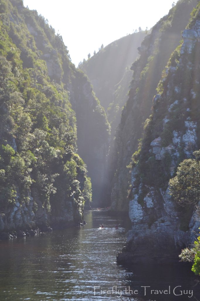
On this specific visit I got the the river mouth at the same time as one of the Untouched Adventure‘s Kayak and Lilo tours. I got to do this awesome activity a couple of years ago and it’s no wonder it previously won the SA Tourism Lilizela Award for Most Scenic Activity in South Africa. The activity starts at the rest from where you row across the bay to Storms River Mouth. After paddling under the suspension bridge, you head up the narrow gorge before transferring onto lilos when the water becomes too shallow for the kayaks.
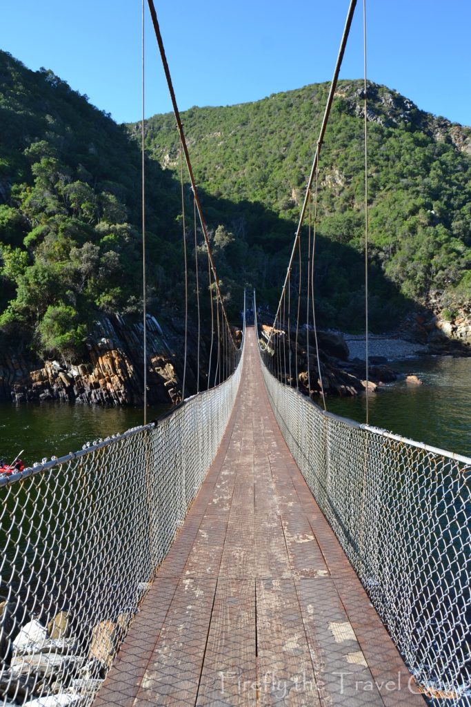
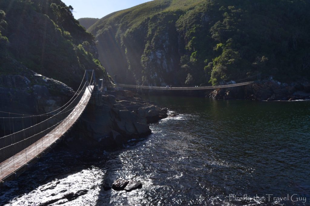
At this stage you arrive at the suspension bridge across the river mouth. The bridge is 77 meters long and hangs just seven meters above the river as it flows into the Indian Ocean.
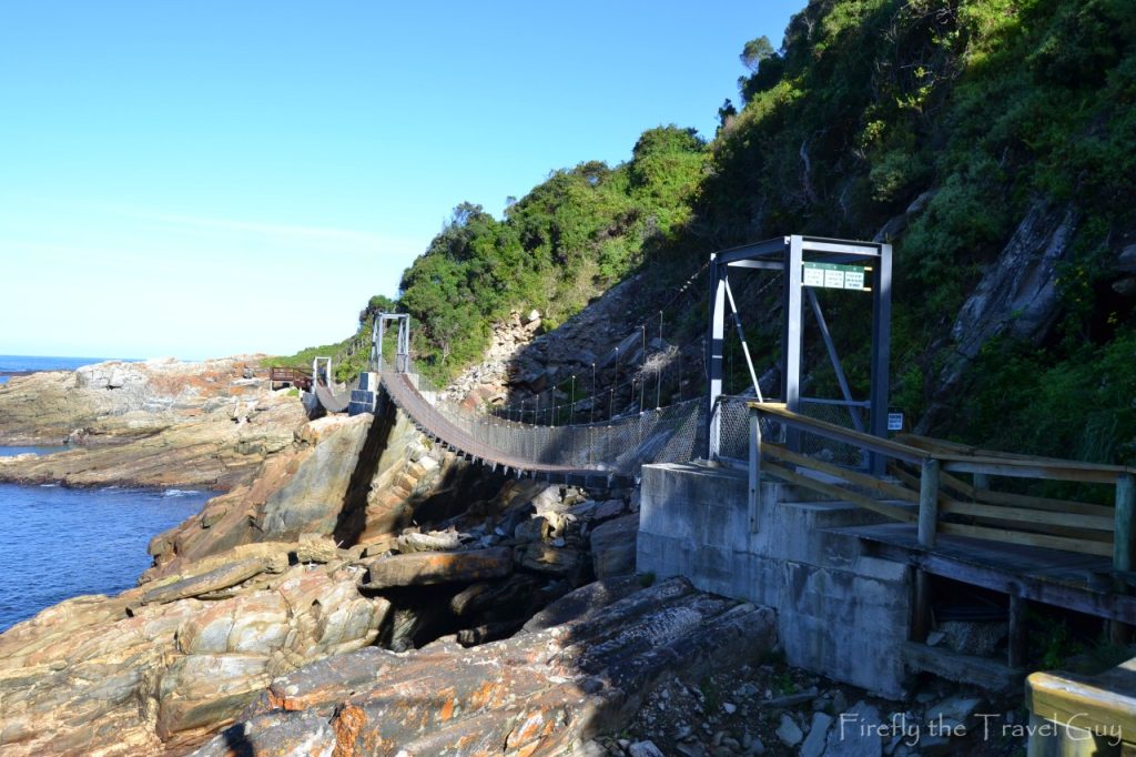

The bridge is probably one of the most photographed sites on the Garden Route, along with the Knysna Heads. It definitely is the highlight of your visit to the park.
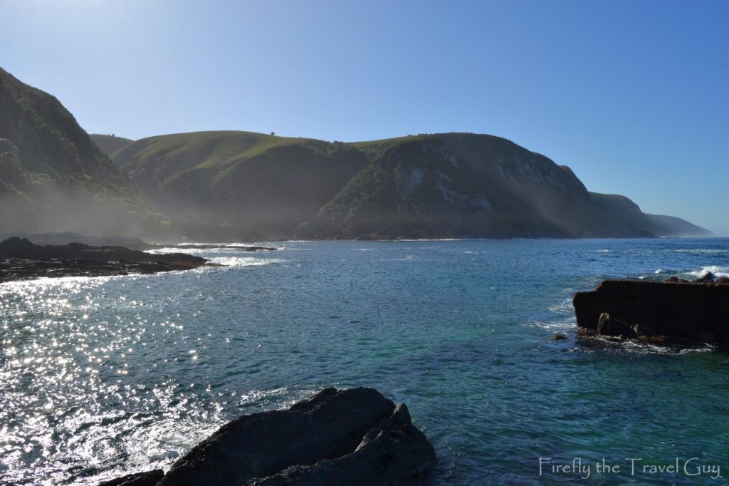
Halfway across the bridge, you get a glimpse of what it looks like up the gorge, and on the other side of the bridge is a small cove with a beach of boulders. You can also climb, because you definitely won’t be walking, up the path to the top of the cliffs on the eastern side for the magnificent view back along the coastline.
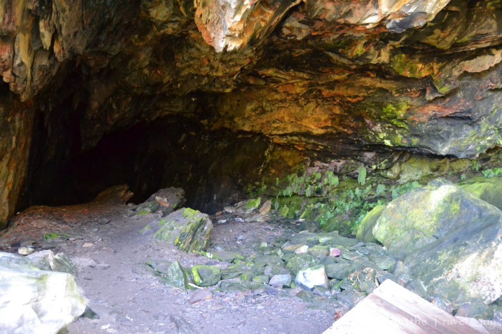
Back across the bridge, you can do a little detour to the Strandloper cave for a look inside. Evidence has been found that Khoi hunter-gatherers made this cave their home and lived off the coastline.
At this stage all the sights and sites have been seen, but you’re only halfway on your walk. Now, to retrieve your steps back along the boardwalk to the rest camp. Remember that rest stop at the waterfall, hey.