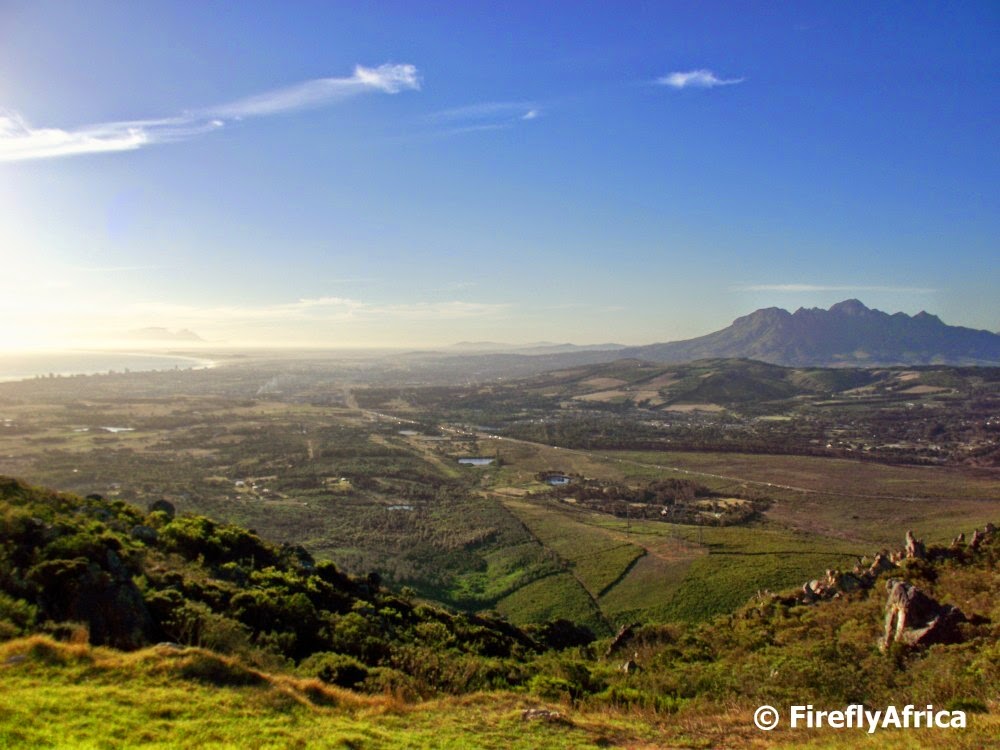
The first sighting of the Cape, False Bay and Table Mountain one gets approaching from the east is from the top of Sir Lowry’s Pass on top of the Hottentots Holland Mountains. The view sight is situated at the top of the pass and about 920 meters above sea level. The view site gives a beautiful panorama from Gordon’s Bay and Strand on the shore of False Bay on the left towards Somerset West and the Helderberg on the right. In the distance Cape Town and Table Mountain is visible.
The mountain crossing in this region was known by the indigenous Khoi people as the Gantouw or Eland’s Pass and was used as a stock route. The Dutch and British settlers at the Cape built a rough pass called the Hottentots Holland Kloof Pass following the Gantouw route. The first recorded crossing was in 1664 and by 1821 the pass saw about 4500 ox-wagons per year crossing into the interior. The route was unfortunately so severe that more than 20% of these were damaged. The ruts left by these wagons being dragged over the mountains can still be seen and was declared a National Monument in 1958.
Construction on a new pass, about 2 km to the south of the Hottentots Holland Kloof, was started in 1828 by the engineer Charles Michell using convict labour. The new pass was opened in 1830 and named after Lowry Cole, the Governor of the Cape Colony at the time. In the 1930s the pass was widened and tarred with further improvements done in the 1950s and 1980’s to get it to what it is in today. Something a long way from the rough two track route over the mountain.
I've driven that beautiful pass a few times- a couple of times in a rickety car with bad brakes 🙂 That was exciting!I was very interested to read your post about the history of the place.
Lovely review of a lovely pass!